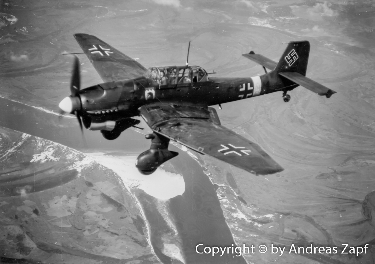
There are few photos of Stuka operations that can be dated so clearly as this set of two – taken by a propaganda company. Both are labeled August 23, 1941. However, despite clear and authentic evidence in the caption, we will see that this still might be misleading – possibly on purpose.
According to the first image’s caption on the back, the aircraft pictured is on its way to the target, flying over the Dnjepr river and ready to dive and attack.
(Archive Andreas Zapf)
With respect to this individual aircraft, it can be said that this is a Junkers Ju 87 B-2 of 7./StG 77.
The coat of arms – displayed below the windshield – shows a dark top area over the yellow background of the shield. The symbol is a gryphon’s head – this is the coat of arms of 7. Staffel.
Furthermore, this aircraft shows the tactical markings F1+AM – again matching the markings of a III. Gruppe aircraft as the loss lists of the Generalquartiermeister confirm (although this specific aircraft is not listed).
There are likely more photos of this series than just the two shown here – the numbers on their back sides are giving them away as No. 1163/1 and 1163/4 – so at last two more must have existed. (or maybe still exist, I’d be curious to learn…)
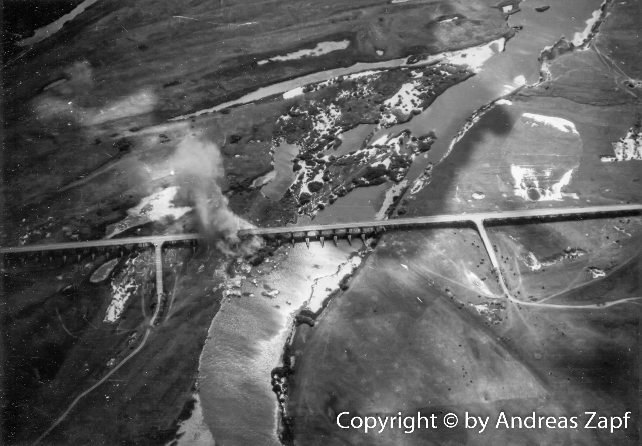
The second photo shows the results of the Ju 87’s operations – a bridge (said to be at “Nawos am Dnjepr”) which had been attacked by Ju 87’s of 2./StG 77.
(Archive Andreas Zapf)
Again, the date given is August 23, 1941. That, however, is a bit awkward: from the chronicles of I./Sturzkampfgeschwader 77 written by Kurt Scheffel it is confirmed that at least I./StG 77 and II./StG 77 are located at the airfield of Biala-Zerkow between August 6, 1941 and August 16, 1941. As of August 17, 1941, Kurt Scheffel writes:
“The entire Gruppe had been withdrawn from the front lines, most likely on the 17th or 18th. It was sent to Kanth, southwest of Breslau.”
Lt. Kurt Scheffel in his written unit history of I./StG 77
Between August 11, 1941, and August 17th, 1941, at least I./StG 77 was involved in heavy counter attacks of Soviet forces in the area of Boguslaw. There, few Wehrmacht units were left while all others are now moving towards the city of Kiev. With the result of a Red Army push into that area. Here is how Kurt Scheffel remembers these days:
“Up until my last day in the east, we were battling two armored trains which manged to cross the Dnjepr near Kanew westbound and were giving our ground forces a hard time.
We managed to destroy both trains but our attempt on the bridge was futile. For one thing, the bridge was pretty high and secondly, the bridge had a wooden construction, some kind of a grid, and our bombs would simply fall through. In addition, the bridge was heavily guarded by flak which happily picked us up as targets but we got away with no losses.”
Lt. Kurt Scheffel in his written unit history of I./StG 77
A closer look at the photo of that destroyed bridge shows two things: it could be a railway bridge as tracks seem to be visible on the bridge. And secondly, there is indeed a lot of blown away wooden grid structures visible in that image – and the bridge in fact seems undamaged.
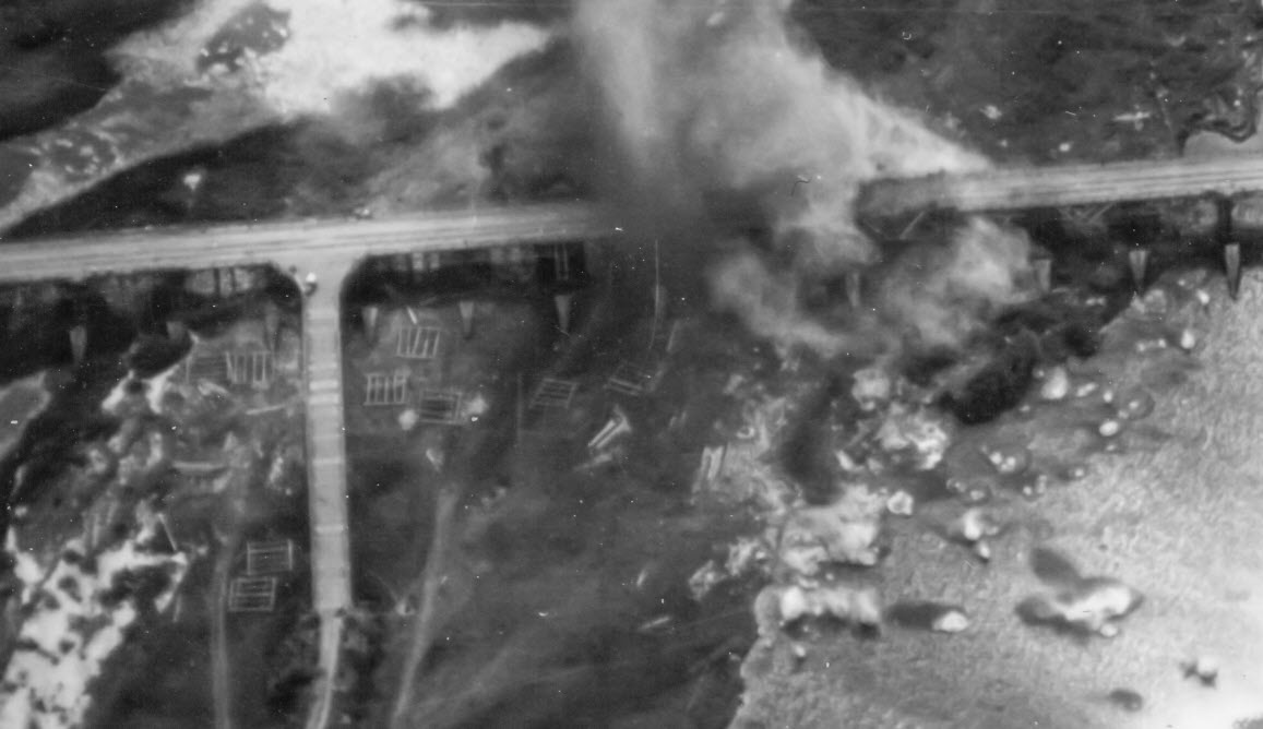
Is there proof that this is the bridge at Kanew (as opposed to “Nawos”)? Nope – it is not. The bridge at Kanew was a metal grid structure which even today is standing in parts. If you want to check it out, use Google Maps.
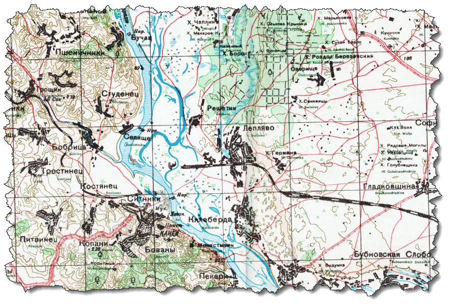
The map – which is dated 1940 – does not show the bridge itself but it is not hard to complete the map by connecting both “dead ends” of the railway running along. Given that the bridge structure does not match, this can’t be the bridge in our photo.
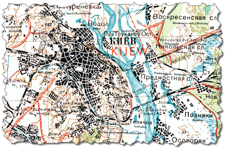
Following the river north, the next potential bridges are at Kiev but these are unlikely the one in out picture above – the surrounding landscape does not match that of a major city stretching to the banks of the river – so these three are likely “no matches” either.
Unfortunately, the next map “north” – M-36-IV (West) Njeshin – is missing. The next one, M-36-I (West) Tschernigoff, however, is available. It shows the village of Nawosy on the southern part of the clipping and another railway bridge north at Nedanchichi.
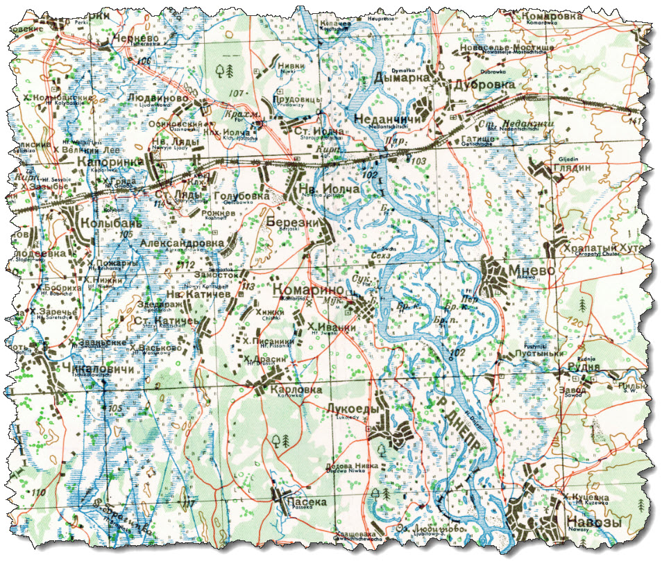
Currently, I don’t have any photos of the bridge itself but at the German military archives in Freiburg, there is a set of reconnaissance photos available, stretching from Nawozy to Tschernigow so maybe – just maybe – that bridge is also covered. We will see…